MulmurOne property, every answer
Thirty-three acres in the Mulmur hills, mapped once and turned into the sheets an engineer, a planner, a builder or a land trust would ask for.
Explore it in 3D
Engineering and planning
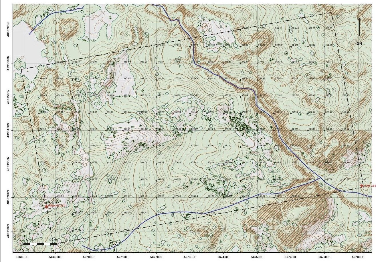
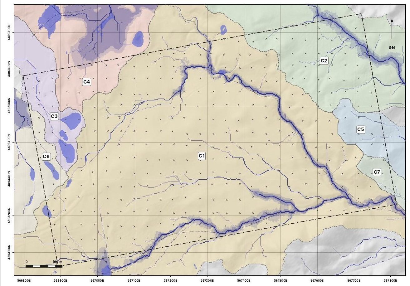
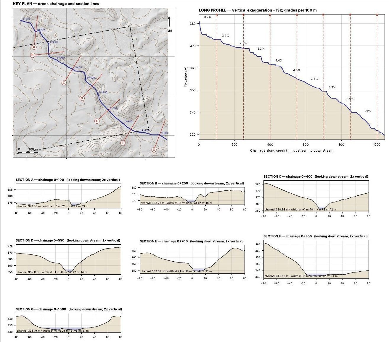
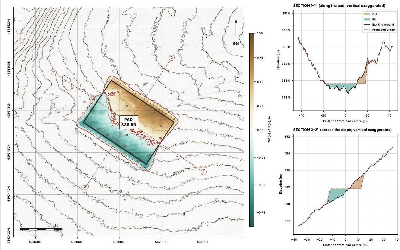
Topographic base plan1 m contours, spot heights, woodland edges and slopes too steep to build on.Surface drainage planWhere the rain goes: catchments, flow paths and wet hollows.Creek profile and valley sectionsHow the creek falls, and the shape of its valley, section by section.Building pad: cut and fillHow much earth moves to set a house into the slope.
Land trust baseline
The maps a conservation easement needs: what's there today, and how to keep watch on it.
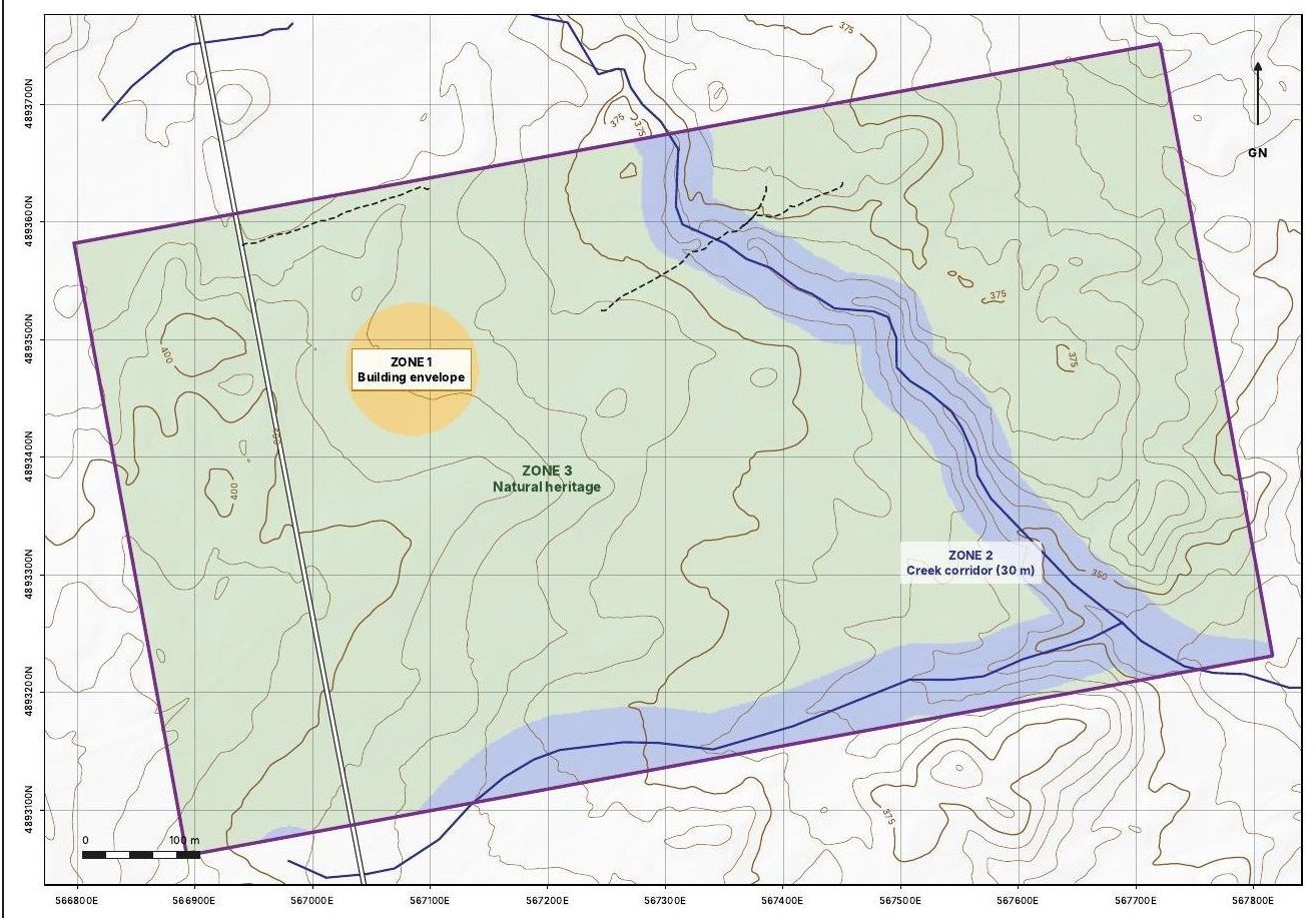
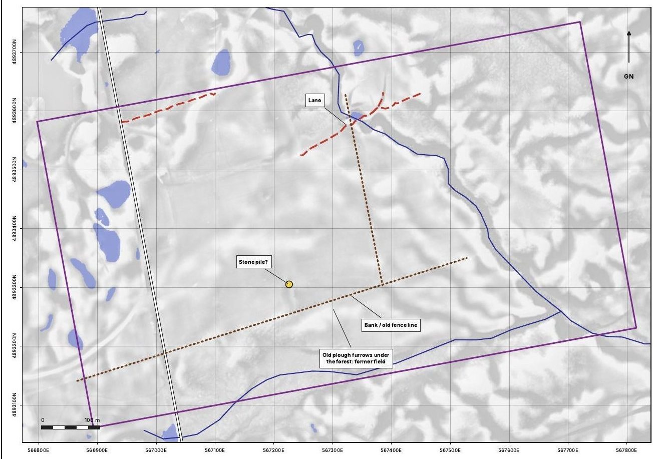
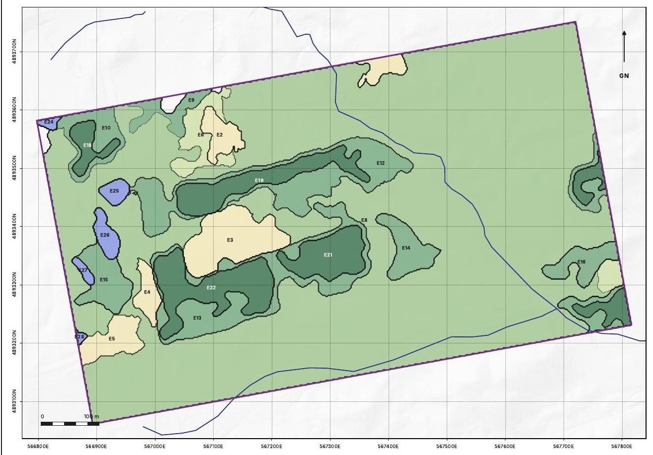
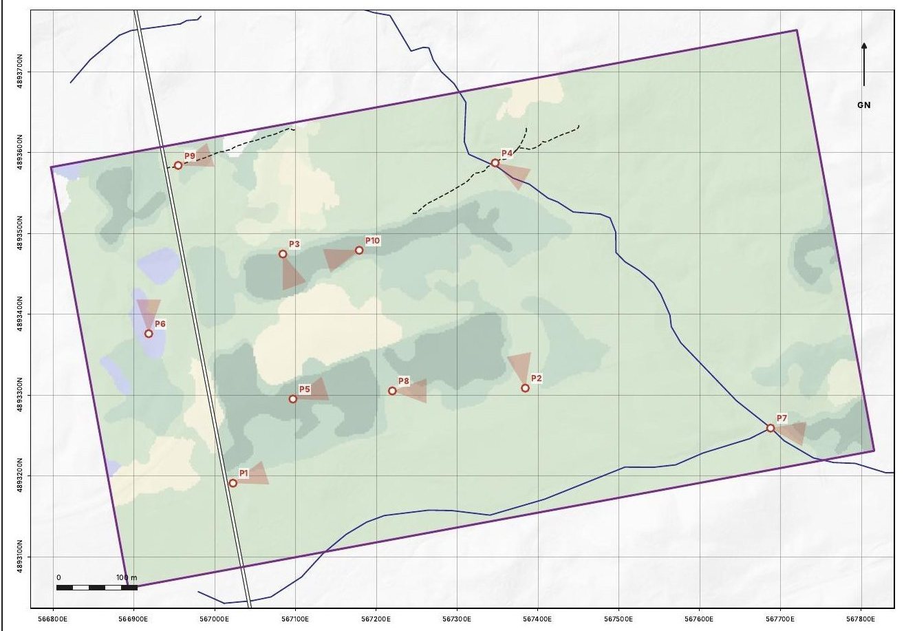
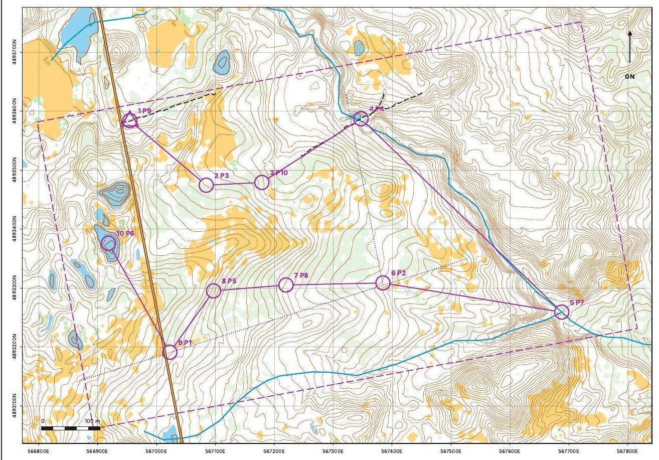
Conservation agreement base mapThe zones: building envelope, creek corridor and natural heritage.Improvements and disturbancesOld lanes, fence lines, plough furrows and a mound to check.Vegetation communitiesForest and field types, mapped across the whole property.Photo point mapPermanent photo points, so change can be seen year after year.Monitor's field mapThe walking route for the yearly visit.
Samples for screening and planning. Property lines are illustrative and these are not legal surveys or engineering designs.